College of Arts and Humanities
Geospatial Intelligence and Sustainability, BA
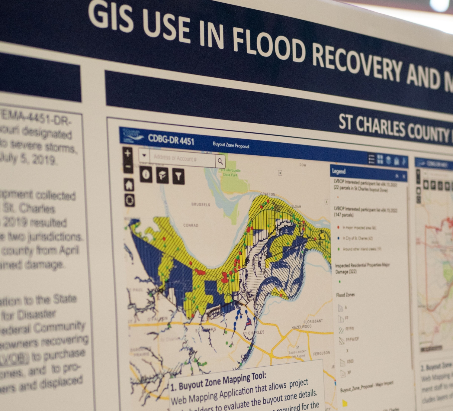
Lindenwood GIS Day and GeoAI Symposium
October 22-23, 2026
If you are curious about GIS, how geospatial technologies are used throughout the St. Louis region, or simply what geospatial looks like specifically at Lindenwood, then please come join us and discover the technologies and career opportunities yourself.
Bachelor’s Degree offered in Blended format.
Turn geospatial data into real-world solutions.
Lindenwood University’s Bachelor of Arts in Geospatial Intelligence and Sustainability prepares students to use geographic information systems (GIS), remote sensing, and spatial analysis to solve today’s most pressing global and community challenges. Through hands-on coursework and interdisciplinary study, you’ll learn to collect, analyze, and visualize geographic data while exploring topics such as sustainability, international security, public history, and public health.
As part of the program, you’ll also earn a stackable Geographic Information Systems (GIS) certificate, giving you valuable technical credentials before graduation.
Why Earn Your Geospatial Intelligence and Sustainability Degree at Lindenwood?
Develop technical expertise in Geographic Information Systems (GIS), remote sensing, drone technology, coding, and spatial data analysis. These highly marketable skills are used across government agencies, nonprofits, healthcare organizations, environmental consulting firms, and private industry.
Tailor your education by choosing coursework in one or more concentration areas, including:
- International Peace and Security
- Public History
- Public Health
This interdisciplinary approach allows you to align your studies with your career goals and interests.
Apply what you’ve learned through an internship that provides professional experience before graduation. Students graduate with both classroom knowledge and practical skills employers value.
In addition to your bachelor’s degree, you’ll complete coursework that leads to a stackable GIS certificate, demonstrating specialized technical expertise to future employers.
What You’ll Study
Students complete coursework in:
- Geographic Information Systems (GIS)
- Remote Sensing
- Spatial Data Analysis
- Applied Artificial Intelligence
- Geography
- Drone Technology and Coding
- Statistics
- Sustainability
- Research Methods
Students then customize their education through concentration coursework focused on public health, international affairs, public history, or an approved interdisciplinary pathway.
Career Opportunities
Graduates with a Geospatial Intelligence and Sustainability degree may pursue careers such as:
- GIS Analyst
- Geospatial Intelligence Analyst
- Remote Sensing Specialist
- Environmental Analyst
- Sustainability Coordinator
- Urban or Regional Planner
- Public Health Data Analyst
- Emergency Management Analyst
- Intelligence Analyst
- Geographic Data Specialist
- Conservation Planner
- Research Associate
Why Study Geospatial Intelligence?
Organizations across nearly every industry rely on geographic data to make smarter decisions. From disaster response and environmental conservation to public health initiatives and national security, geospatial technologies help professionals understand how location influences people, resources, and communities.
By combining technical GIS training with interdisciplinary subject matter expertise, graduates are prepared to analyze complex problems and develop data-driven solutions that create meaningful impact.
Program Highlights
- Includes a stackable GIS certificate
- Hands-on GIS and remote sensing experience
- Internship opportunity
- Interdisciplinary curriculum
- Multiple concentration options
- Emphasis on real-world applications and data-driven decision making
Frequently Asked Questions
Yes. As part of the Geospatial Intelligence and Sustainability program, you’ll earn a stackable Geographic Information Systems (GIS) certificate. This additional credential demonstrates your technical expertise in GIS and spatial analysis, helping you stand out to employers before you graduate.
Graduates are prepared for careers in government, environmental consulting, public health, emergency management, nonprofit organizations, and private industry. Common career paths include GIS analyst, geospatial intelligence analyst, environmental analyst, sustainability coordinator, remote sensing specialist, and urban or regional planner.
No. The Geospatial Intelligence and Sustainability program is designed to help students build technical skills from the ground up. Through hands-on coursework, you’ll learn Geographic Information Systems (GIS), remote sensing, spatial data analysis, and other technologies used by today’s employers.
Shenika Harris, Ph.D.
Associate Dean, College of Arts and Humanities